Saturday, August 20, 2016

Warkworth Castle, Warkworth

Warkworth Castle
Warkworth
Northumberland

Above. The gatehouse at the South end of the site.


Above. The Keep viewed from the gatehouse.

Above. The ruins of the 'Little Stair Tower'.

Above. The John Lewyn designed Keep.

Above. The postern gate in the West wall.

Above. The postern  gate showing the thickness of the curtain wall.

Above. The Vestibule in the Keep.

Above. Inside the 'Little Stair Tower'.

Above. The Lion Tower.

Above. Another view of the Keep.


Above. The ruined Carrickfergus tower at the South Western corner of the curtain wall.

Above. View of the Carrickfergus tower from the footpath.

Above. External view of the West wall postern.

Above. View of the Keep from the footpath to the West of the castle.

Above. Another external view of the West wall postern from the footpath.

Above. Another view of the Keep from the footpath to the West.

Above. The Keep from Castle Terrace to the East.

Above. The gatehouse at the South of the castle grounds.


Castle Sween, Loch Sween, Scotland

Castle Sween
Loch Sween
Knapdale
Argyll
Scotland

As usual, Scotland delivers yet another fantastic castle in some of its most beautiful scenery. Castle Sween is situated on the Eastern shores of Loch Sween on the West coast of Argyll, Scotland. In all probability, Castle Sween is one of the earliest stone castles built in Scotland, dating as it does from the late 12th century. 

The name Sween, is the anglicised version of Suibhne, the name of the most likely builder of the castle, possible grandson of Hugh the Splendid O'Neill, Prince of Argyll. The Clan MacSween traditionally governed huge swathes of land from Loch Awe in the North, to Skipness Castle on the shores of Loch Fyne in the South. However, the MacSween's lands in the area surrounding Knapdale (including the castle here on Loch Sween) found their way into the hands of the Stewart Earls of Monteith. As a result of this, the MacSweens pledged their support to Edward I in an attempt to wrest their lands back from the Stewarts during the Scottish Wars of Independence. Unfortunately their plans failed, and they were swiftly removed from all of their lands by the newly crowned Robert the Bruce. 

Robert the Bruce then went on to lay siege to Castle Sween which was being held by Alasdair Og MacDonald. Alasdair surrendered and was disinherited, losing Castle Sween, his lands and his titles to his younger brother Angus Og MacDonald. Edward II granted John MacSween the ancient ancestral lands around the Knapdale area, but the castle on Loch Sween was then held by Sir John Monteith. Sir John died in 1323, and the Lordships of Arran and Knapdale passed to his son and grandson. A large portion of Knapdale then passed to the MacDonald clan in 1376 when it was granted to them by Robert II of Scotland. 

The castle was passed to Historic Scotland's predecessor, the Historic Building and Monuments Directorate in 1933.

Above. Castle Sween on the Eastern shore of Loch Sween (photo courtesy of John Jefferies)

The castle consists of four thick sturdy walls surrounding a courtyard. The walls have thick buttresses in the centre of each stretch of wall and at the angles, providing further re-enforcement. The gateway is in the South wall, providing exit and entry to the courtyard through ten foot thick walls. 

During the 13th century, the North East corner of the courtyard wall was demolished and a tower house was built, possibly to provide more appropriate and comfortable accomodation for the castle's stewards. 

The Western wall of the courtyard was altered during the 15th century, and a round tower, the MacMillan tower, was added to the castle's defences. 

Castle Sween was attacked in 1644, during the Wars of the Three Kingdoms, by Alasdair MacColla and the Irish Clan Donald. Such was the damage wrought during this attack, that the castle was rendered uninhabitable. The castle was never repaired and has been a ruin ever since. 

Tuesday, August 16, 2016

Druridge Bay, WWII beach defences

Druridge Bay
Near Cresswell
Northumberland

Frequent walks on the beaches around Cresswell and Druridge Bay in Northumberland on a recent family holiday, rewarded me with these images of World War II beach defences, still visible in the white sands.  Stretching from Brig Head just to the South of Cresswell, right to the Hadston Carrs to the North, the beach is littered with the remains of pill boxes, tank traps and anti-tank ditches, paying testament to the seriousness of the threat of German invasion during the war.

Above. Pill box almost hidden in the sand dunes.

The pill box shown above and below, has at some point been undermined by the sea over the last 71 years, the constant battering of North Sea storms and tides causing it to be some way from its original position. This would have been one of a number of pill boxes positioned along the beach, designed to slow down and impede any potential invasion from mainland Europe.


One of the pill boxes, situated at the top of the sand dunes next to the road, was designed to look like a derelict cottage. There's a photo of this bizarre building here, and here.

Above. Concrete blocks making up tank traps, hidden in the dunes.


Above. Second row of tank traps.


There are literally dozens of these cubes of concrete scattered all along the beach along Druridge Bay. They were deposited in the sand, and designed to impede the progress of any tanks that invading forces would have wanted to unload from landing craft. 

Monday, August 15, 2016

Alnwick town gate, Alnwick

Alnwick town gate\Hotspur Gate\Bondgate
Alnwick
Northumberland

Otherwise known as the Hotspur Gate or the Bondgate, Alnwick's sole surviving gate house sits at the junction of the aptly named Bondgate Within and Bondgate Without, Hotspur Street and Greenwell Road, South East of the castle. It was originally built as part of the wider town's defences, and with Alnwick being the epitome of a 'town on the front-line' it was a necessary defensive feature of this much raided English town. Alnwick was the chief seat of the Percy family, who were almost always at odds with their Scottish counter-parts, the Douglases. Indeed, even before the Percys and the Douglases began trading blows, Alnwick had been raided on numerous occasions by Scottish armies. Malcolm III was defeated and killed at Alnwick in 1093, and William the Lion was defeated and captured here in 1174. William Wallace also attacked Alnwick in 1297. In 1428, the Douglases launched an attack on Alnwick, prompting murage to be granted to the town. Walls and gates were therefore constructed from 1434 onwards.

Above. View of the gate from the B6346 , looking East from within the town.

The Hotspur gate was either still being built, or had just been completed in 1448, when another Scottish raid was launched against the town. From 1452 onwards, the sum of £20 a year was made available to maintain and repair the walls and gates.

The Hotspur gate was originally one of four gatehouses built to defend entry into the town. The others, the Clayport Tower, the Pottergate Tower and the Narrowgate Tower have all long since been demolished and have vanished altogether. None of Alnwick's walls have survived either. Hotspur was a nickname given to Sir Henry Percy, occasionally referred to as Harry Hotspur

Above. View of the gate from the B6346, looking West from outside the town.

The tower's central passage is around 3.5m wide and retains its porcullis groove within the four-centered arch. The towers, more readily visible from outside the town, are around five meters wide built over wide chamfered bases. Each of the two conjoined towers has its own guard room, accessed from within the passageway with loops facing both into and out of the town. A tiny trace of the nearly two metre thick wall survives on the South Western side of the tower. 

St Lawrence, Warkworth

St Lawrence
Warkworth
Northumberland

Situated in the wonderful village of Warkworth within a loop of the river Coquet, the church of St Lawrence, Grade I listed, hints at one of the those rare churches.....a church built for protection or defence. It is however debatable, and the claim of a 'defensive church' rests mainly on the thickness of walls, the relative small size of the original windows, and a local story of an attack by Scottish soldiers led by Duncan, Earl of Fife (Donnchad II) C.J. Brook, in his book Safe Sanctuaries, mentions a chamber above the stone vaulted chancel, but let's not forget that Brook also mentions St James of Burton in Kendal as a fortified church, a building that would not have worked as a place of defence in the slightest! The attack by the Scots is a more interesting story, and follows roughly the same narrative as the story connected with Kendal's Parish church (Kendal, Cumbria) in which forces led by Duncan, Earl of Fife, in 1189, attacked Kendal, setting fire to the church and killing "the inhabitants of Kendal". The attack on Warkworth, is reputed to have taken place on the same day as the Battle of Alnwick, on the 13th of July, 1174, a battle in which William the Lion of Scotland was captured by Ranulf de Glanvill. In Warkworth's story, set some fifteen years before the attack on Kendal, the town's inhabitants sought refuge in the church, but were killed when the building was set alight, along with other buildings in the town, killing around three hundred people. 

Above. Old post card (from personal collection) showing the church of St Lawrence.

The church we see today, dates from the late 1100s, and replaced an earlier (Saxon) church that stood on the same river side site. The original church, mentioned in writings from 737, most likely succumbed to the Viking raids of 875, when Halfdan Ragnarsson led an army along the River Tyne, destroying and plundering towns and villages along the way. During the 9th and 10th centuries, the church was rebuilt in stone, this early building being discovered during repair works in 2008. 

Above. The church as viewed from Warkworth Castle.

In 1120, Henry I gave the church of St Lawrence to Richard de Aurea Valle, along with churches at Corbridge, Whittingham and Rothbury. These churches later became part of the Diocese of Carlisle when it was formed in 1133. 

Above. The church viewed from Dial Place.

The tower was built sometime around 1200, with the belfry and spire being added in the 14th century. A South aisle and a traditional porch in the Southern wall were added in the 15th century.

Above. The tower from Dial Place.

Warkworth was reputedly the first market town in England to proclaim The Old Pretender, James Francis Edward Stuart, as the King, during the early days of the 1715 Jacobite rebellion. 

Above. Floor plan of the church, showing building periods.

Restoration work in 1860, specifically the building of a new roof, resulted in the loss of the clerestory windows from the South wall, the removal of most of the internal wall plaster, as well as the removal of all of the box pews. Work to stop the subsidence beneath the North wall has to some extent been ongoing since the 13th century. Huge stepped buttresses have been introduced in an attempt to stop the church sliding into the river. The church, the castle and indeed the town, along with its beautiful fortified bridge, are all well worth a visit.

Warkworth Bridge, Warkworth

Warkworth Bridge
Warkworth
Northumberland

Warkworth is a wonderful village roughly a mile North of Amble and four miles South of Alnmouth in Northumberland. The village is built in a loop of the River Coquet, only a short distance from the sea. Along with the bridge, the village has a beautiful castle and a stunning church, said by some historians, to have been built as a place of refuge. Warkworth bridge spans the River Coquet at the Northern end of the village, taking the A1068 North to Alnwick. 

Above. View of the bridge from the riverside to the West.

Warkworth bridge is one of only two bridges that have managed to retain their defensive towers, the other being Monnow Bridge in Monmouth, Wales. The bridge is around eleven feet wide, and hence unsuitable for the amount of traffic passing through modern day Warkworth. A new road bridge has been constructed, bypassing the medieval bridge altogether. It consists of two arches, and has a neat central pair of pedestrian refuges in each wall above the triangular cut-waters.

Above. View of the bridge's tower from the riverside.

The tower is situated at the Southern end of the bridge, and is known as Bridge Head Tower. The bridge was built in 1378, and paid for from a bequest made by John Cook of Newcastle, who left 20 Marks towards the construction of a new bridge and its tower. The tower is ruined above the ground floor and roofless, but would have once housed a 'guard room' where a porter would most likely have lived. His responsibility would mainly have been for monitoring traffic coming into and leaving the village....more of a toll house than a pele or solar tower.

Above. The bridge's tower looking North from Bridge Street.

The tower is roughly eight and a half by five and a half metres, and would have originally stood to two storeys. A newel stair can still be seen giving access to the upper storey. The upper chamber has a fireplace...always a good indication that a building such as this was intended to be occupied, if not full time, then for long periods. 

Above. The bridge and its tower from Bridge Street.

Above. The tower from Bridge Street.

The bridge and the tower are, surprisingly, only Grade II listed, though the whole structure also has Scheduled Ancient Monument status. It's great that the bridge and tower are freely accessible and not blocked off and locked up. 

Low Chibburn Chapel, near Widdrington

Low Chibburn Chapel
Near Widdrington
Northumberland

Above. Low Chibburn Chapel from the South.

Above. Low Chibburn Chapel from the South.


Farne Island pele tower, The Farne Islands

Farne Island pele tower
The Farne Islands
Northumberland


Cresswell Tower, Cresswell

Cresswell Tower
Cresswell
Northumberland


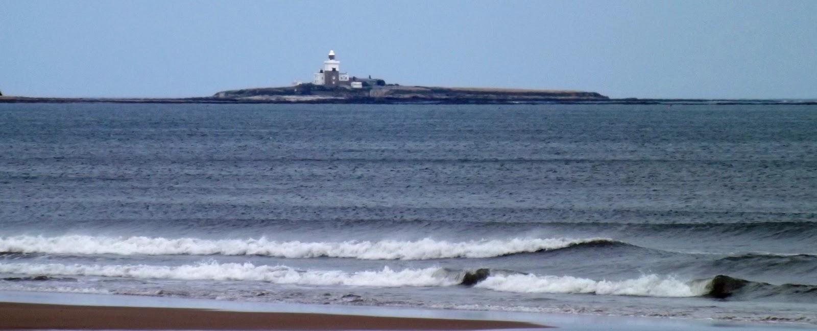
Coquet Island, Northumberland

Coquet Island
Northumberland


Dunstanburgh Castle

Dunstanburgh Castle
Dunstanburgh
Northumberland


Bamburgh Castle, Bamburgh

Bamburgh Castle
Bamburgh
Northumberland


Widdrington Castle, Widdrington, Northumberland

Widdrington Castle
Widdrington
Northumberland

No castle, but just a field with a few lumps and bumps....but as with many of these sites, looks can be very deceiving. The small village of Widdrington lies South of Warkworth and a mile or so inland from Druridge Bay in Northumberland. This is a very difficult site to find, most notably because there simply isn't much to see any more. The best views are to be found to the East of the farm buildings, from the B road that runs along the coast at Druridge Bay and takes a sharp Westwards turn inland. From here the slight earthworks can be seen in the field to the South of the farm buildings. Alternatively, the site can be viewed from the churchyard of nearby Widdrington Parish Church to the West of the site. 

Above. View of the castle site from the West.

Land around the site was owned by the Widdrington family from the 12th century, but it wasn't until September the 10th, 1341 that Gerard Widdrington was granted a license to crenellate his family home. The Widdrington family bore several Sheriffs of Northumberland. 

Above. View of the castle site from the church yard to the West.

Above. Buck brother's illustration of the castle before demolition.

Gerard's castle was later rebuilt in the early 17 century as a manor house of substantial importance. It was furnished with a large square tower with bartizans as shown in the image above. By 1643, with William Widdrington marrying the heiress of Blankney Hall in Lincolnshire, Widdrington castle ceased to become the main residence for the family. After his support for the Jacobite cause in 1715, his lands and property were taken by the Crown in punishment, and by 1720 the castle was little more than a ruin. An attempt was made to repair and rebuild the property in 1772, but a fire gutted the building, halting the work. A second attempt at rebuilding was made, and the house was lived in for a short while. The building remained uninhabited from 1802, and in 1862 was demolished leaving only the tower standing. By 1903, the last standing portion of the tower was also removed, leaving only the slight mound in the middle of the field.


Saturday, June 25, 2016

Neidpath Castle, Near Peebles, Scotland

Neidpath Castle
Near Peebles
Scotland

Neidpath Castle, a fantastic L-plan tower house, overlooks the River Tweed, roughly a mile to the West of the town of Peebles in the Scottish Borders. 

It's likely that this position on the river, was originally occupied by a small castle, probably built around 1263 -1266, by Sir Simon Fraser whilst he was the High Sheriff of Tweeddale. During the 14th century, the Neidpath barony was absorbed into the Hay family's fortunes....and it was Sir William de Haya that most likely built a castle or tower house on this site in the late 14th century. The lands in this area were successfully held by the Hay family right through to the 17th century. The principle seat of the Hay family at this time was Yester Castle, though the family still used Neidpath on occasion.

In 1563 Neidpath played host to Mary Queen of Scots, and then, some twenty four years later, to her son, James VI. In 1645, Neidpath was garrisoned against James Graham, 1st Marquess of Montrose (Royalist) by John Hay of Yester Castle. The following year he joined the Kings cause, and received the Earldom of Tweeddale as a reward from Charles II. In 1650, as Oliver Cromwell invaded Scotland, Neidpath was attacked by the advancing New Model army. Historians disagree as to whether it was simply surrendered to Cromwell's forces, or if it suffered some sort of siege. It's quite possible that the 13th century tower, built by Sir William de Haya, was destroyed by artillery fire at this time.

Above. Looking North across the River Tweed. 

In the 1660s, the 2nd Earl of Tweeddale, John Hay, was declared bankrupt. To satisfy his creditors and raise money to pay off his debts, he was forced to sell Neidpath to William Douglas, 1st Duke of Queensberry. Douglas later gave the castle to his son, William Douglas (later 1st Earl of March) William Wordsworth and Sir Walter Scott are both said to have visited the castle during William Douglas' ownership. When William died, in 1810, the castle, with the Earldom of March, passed to the Earl of Wemyss. To this day, the castle still belongs to the Earl of Wemyss, and the title, Lord of Neidpath is still a courtesy title held by the current owner.

Above. Looking West along the footpath leading to the castle.

The L-plan tower was somewhat neglected during the mid to late 18th century, so much so that, in 1790, part of the upper floor of one of the wings collapsed.....damage that can still be seen today. The battlements are roofed, a luxury seldom seen in Scottish tower houses. The tower house still has very few windows, a structural point that is usually changed over the years in most tower houses as they become comfortable homes rather than defensive buildings. The first floor hall and the basement are vaulted.

Above. Old print of Neidpath Castle.

The castle is not open to the public, though it can be viewed from across the river, and from the approaching path that runs to the East of the castle.

Neidpath Castle's own website.

Photos used by courtesy of Adrian Leach (copyright 2016)

Friday, June 17, 2016

Breaking News - The Castle Studies Trust increases castle studies grants

Breaking News - The Castle Studies Trust increases castle studies grants.

Good news for castle lovers and history buffs....the Castle Studies Trust are now able to offer grants of up to £7500 for the funding of investigative projects starting from September this year. 

Jeremy Cunnington, the Castle Studies Trust's Chair of Trustees, says of this increase in funding "This is great news as it will allow us to fund bigger and more diverse projects and is part of our long term aim of continuously increasing the maximum amount we can award per grant to the point where we can look to fund a full scale research excavation."

The Trust enables the investigation and surveying of castles around the UK, improving our understanding of these magnificent buildings and raising awareness of their sometimes perilous state.

For more information about the grant process, check here.

Check here for recent news on Gleaston Castle in Cumbria.