Friday, September 15, 2006


Thursday, September 14, 2006
Trainford Brow, nr Clifton
Nr Clifton,
Cumbria
 Above. A view of the cairn looking West.
 Above. A view along the top of the cairn, looking East.
 Above. A view of the cairn, again, looking West.
Medieval settlement, Selside
Nr Selside
Cumbria
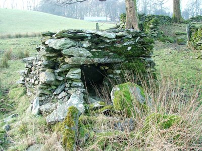
Charcoal burning pit?
The site consists of an inner bank running around two thirds of a moated island, a single earth bank on the South East side, and a double earth bank on the North West. The island is accessable from the North corner, but apparently traces of a causeway have been found in the Western corner.....although I couldn't find these remains!!!
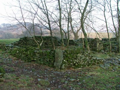 There are feint earthwork remains on the island (now merely a raised area in a boggy marshy area) To the South East of the moated area, lay the remains of the long house.
These are by far the most impressive part of this site, and survive in places, to around a meter and a half high. There are definitely two rooms to the long house, with piles of slate rubble where the walls have otherwise collapsed. The remains of a charcoal burning pit have apparently been found in the area, although I was unable to track this feature down.
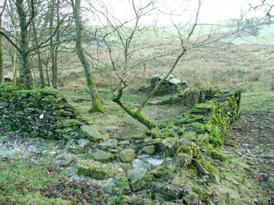 I'm not sure if the moated site was a defencible structure, or just an enclosure for keeping animals. However, it was quite an impressive site at the end of a pleasant woodland walk.
Berry Holme Round cairn, Helsington
Helsington
Nr Kendal
Cumbria
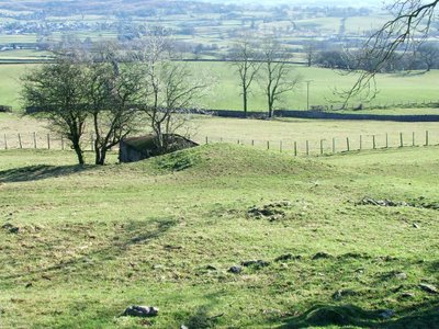
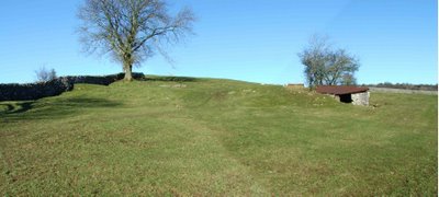
Dalton Deserted Medieval settlement
Burton In Kendal
Cumbria


Thursday, August 24, 2006
Killington Hall, Killington
Killington
Cumbria
 Built in the early 1400's, probably by the Pickering family, the original pele tower was sited over the top of an earlier 14th century moated site, and consisted of a three storey defensive structure.
The crenellations have long since gone, as has most of the top floor, presenting us today with the empty shell of the tower, attached to the 17th century hall or manor house.
 The tower, still attached to the house which is inhabited to this day, has no structure within its walls, except for the timber remains of a 19th century larder. The floors have long since collapsed, and the roof is also gone. Some of the fine sand stone windows are still intact, and the moat is little more than a boggy stream surrounding the tower on three sides.

 Killington hall is rare, in that the original hall\tower, is preserved along with the original manorial chapel. Unfortunately, the church was not open on the day I visited the hall...a good excuse to re-visit.
Kilchurn Castle, Glenorchy and Inishail
Glenorchy and Inishail
Lochawe
Scotland


Wednesday, August 23, 2006
Tower of Refuge, Isle of Man
Douglas Bay
Douglas
Isle of Man

 Built at a cost of around £255, the tower was designed by John Welch, and consists of three towers linked together to form a triangular structure, with a single tall square tower behind it. The tower's purpose is to provide a safe haven in the event of a wrecking. It is now in the hands of the RNLI, whos flag flies from the tower.
The Tower of Refuge at low tide. (Photos courtesy of Martin Russell)
Castle Rushen, Castletown, Isle of Man
Castletown
Isle of Man
 Interior of the curtain wall. (Photo courtesy of Martin Russell)
 Part of the keep. (Photo courtesy of Martin Russell)
Saturday, August 19, 2006
YORK: Acomb: ROC Group HQ No 20
Cold war bunker
Acomb Road
York
Yorkshire
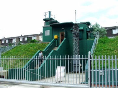 The bunker is a semi-submerged structure, built into a mound of earth a story high, and accessed by a flight of stairs up the outside. The bomb proof door is still in situ, as is the pump up arial at its side. Once inside, there are an further two floors beneath the earth.
Well worth a visit.
Clifford's Tower, York
York
Yorkshire
 In 1190, the keep of the motte was severely damaged by fire in the anti-Jewish riots that took place in the city. Once again, the castle was re-built, this time on a higher motte. In both these periods (pre and post fire) the castle was built in wood....a state of play that remained unchanged until the 13th century. During 1902\03, archaeological digs on the motte discovered a layer of charred material, probably relating to the fire of 1190....this material laying some thirteen feet below the summit of the motte, demonstrating the rebuilding that took place after the devastating fire. The castle was surrounded on three sides by the Rivers Foss and Ouse, helping to provide the fortification with enhanced protection.
 In 1228 disaster struck again, when the wooden castle was blown down in a gale. No rebuilding work was done for 17 years, until Henry III gave instructions for the castle to be rebuilt in wood and stone. By 1270, the castle was once again complete. Two of Henry III's chief castle builders were employed to make sure that the castle was built to its maximum strength: Henry de Reyns, Henry's master stone mason, and Simon of Northampton, Henry's master carpenter.....both of whom had worked on Windsor Castle. Over the next twenty or so years, over £2500 was spent on improvements. It is thought that the quatrefoil design for the tower was taken from Henry de Reyns tower at the Chateau de'Etamps, some thirty miles South of Paris. Each lobe of the tower possessed two arrow slits, allowing those occupying the castle to keep watch in all directions. Significant repairs were required after flooding in 1315 and 1316, and yet more in 1360 when part of the motte collapsed causing cracks to appear in the tower's walls. Some £200 was spent during this period, on repairs, and some of the repaired cracks are still visible today.
 The castle was largely untouched until the 1660's, most likely due to the diminishing threat from North of the border. From the early 1500's, the castle became more of an administrative centre than a military stronghold, and it was allowed to fall into a state of disrepair. In 1596, the city gaoler, Robert Redhead was responsible for removing large amounts of roofing material from the castle, and it wasn't until the city council brought the theft to the attention of the crown, that he was stopped.
 The 1600's saw a period of building in the bailey region of the castle, and the keep on the motte transformed into a gaol. The tower was by this time, demoted from a defensive structure in this respect, and the castle promoted to the centre of civil administration for the city. In 1614 the tower was leased out by James I so that he didn't have to pay for the many repairs that the castle required, but at the outbreak of the civil war it was home to a Royalist garrison. In 1643 the upper floors and the roof were strengthened to enable a number of cannons to be stationed there. During the siege of York in 1644, the tower came under fire from Parliamentarian cannon, suffering some minor damage. It was repaired in 1652, and continued to be garrisoned under Charles II. In 1684, a fire spread to the gun powder store in the tower, causing a huge explosion. Much of the wood of the tower was destroyed, and the walls were seriously damaged. Minor repairs were made, and it was garrisoned right up until 1688, when it eventually passed into private hands. As soon as it became a privately owned structure, it lost all military use, and became a 'garden feature' with a spiraling footpath from the foot of the motte to the summit.
The tower, including the castle's building beyond the motte, remained standing through the 1700's, largley unchanged. It wasn't until the 1820's that prison reformers began to demand that the prison conditions at York gaol be improved, and in 1824, a decision was made to enlarge the prison, and provide larger cells, with more security. Land adjoining the castle was purchased for this purpose, and for a short time it looked likely that the tower and the motte upon which it stood was in danger of vanishing for ever. The tower survived though, even though the motte was revetted with a huge wall right around its base. The new prison was built, and the tower was spared....however, other parts of the castle vanished: the gatehouse, most of the curtain wall and most of the buildings within the walls. In 1900 the castle was no longer a public prison, but had been turned over to the military for their use. It remained under their control until about 1929, after which most of the prison buildings were dismantled, except for the debtor's and women's prison which now house the museum. The revetment around the base of the motte has long since gone, and the motte has been restored and strengthened, and the the tower is now open as a tourist attraction.
Thursday, August 10, 2006
Brougham Hall, Brougham
Brougham,
Cumbria


Arnside Tower, Arnside
Arnside,
Cumbria
Built in the late 14th century, Arnside tower is unique amongst the pele towers and tower houses of Cumbria and the South Lakes area, in that it is a free standing tower that never had any surrounding buildings attached to it. It's seen its fair share of disaster and damage as well. It was seriously burnt in 1602, and suffered disastrous damage after a storm in 1884. The fire in the early part of the 17th century caused significant damage, although the structure was important enough for repairs to be made.
 It was occupied until the 1680's, after which, the roof timbers were removed to Beetham and Knowsley. The storm, in 1884, almost totally destroyed the internal cross wall, causing the South West wall to collapse.

The walls that exist today, are around 1.2metres thick, maybe too slight for the tower to be truly classified as a 'pele tower'. Arnside is one of a number of towers that can be found around the Morecambe bay area.
 Other towers in this group include Hazelslack, Wraysholme and Beetham. The tower is situated on a public footpath near Arnside Tower farm sandwiched between Silverdale and Arnside, and is easily accessible for photographing, although the structure is in a very poor state of repair and should not be entered.
 Some commentators have suggested that the tower was originally built as a hunting lodge, and does not actually belong to that well known group of fortifications, pele towers.
 There are no vaulted rooms\basements present in the remains (an important factor when defining pele towers) the walls are, as mentioned above, thin and slight for a pele tower. Some commentators even go so far as to theorise that the tower could in fact be a complete 17th century rebuild (after the fire of 1602) and there is little to date it to the 1500's at all....such is the 'blandness' of the architectural features we see today. Whatever its history though, pele tower or not, this is a very interesting building set in beautiful surroundings. It desperately needs some consolidation work on those walls in perilous condition, if it is to survive into the future.
Monday, July 17, 2006
Multangular Tower, York
York
North Yorkshire


Micklegate Bar, York
York,
North Yorkshire
 Above. The external face of Micklegate Bar, minus its barbican.
In 1569, the Earl of Westmorland commented that Micklegate Bar was the strongest bar, with the strongest portion of wall surrounding the city of York, and to this day, it has to be the most recognisable, and the most impressive of York's gates. It is first documented in records from the reign of Henry II, and some time around 1196, a grant was obtained for a house to be built above the gate. The gate was used, as well as a defensive structure, as a toll booth, with tolls on goods coming into the city being levied here. The barbican on the exterior of the gate, projected some fifty feet beyond the external walls. It was in an extremely poor state of repair by the early 1800's, with several drawings showing walls collapsed and even missing. When one of the side walls fell down in 1810, York Corporation decided that the while of the barbican should be dismantled, although it was not fully removed until 1826. There are four shields above the central arch of the gate: The shield directly above the arch, commemorates the restoration of the gate in 1737, and shows the arms of Lister Kaye. Above this shield, and to both left and right, are shields with the arms of the city of York. The top shield, with a gold helm over it, shows the Royal arms with 'France ancient'.
The gatehouse was used to display the severed heads of executed prisoners. For example:
Sir William Plumpton 1405
Lord Scrop 1415
The Earl of Devon 1461
The Earl of Northumberland 1472
Four of the Farnley Wood Conpirators 1663
William Conolly and James Mayne 1746
 Above. The internal face of Micklegate Bar.
Fisher Gate Postern\Bar, York
York
North Yorkshire
 Above. A view of the tower looking South.
Fishergate is a tall rectangular tower of four storeys. It originally had a flat roof with crenellations. The steepled roof seems to have been in place for a significant period of time...John Speed's map of York, dated 1610, shows it pretty much as we see it today.
 Above. A view of the tower looking East. The postern can be seen to the right of the tower.
The tower had a fireplace, now bricked up, on the first floor, and a spiral staircase in the South corner would have led up to a small turret on the former flat roof.