Sunday, October 26, 2008

Lancaster Castle, Lancaster

Lancaster Castle
Lancaster
Lancashire

Lancaster’s Castle has dominated the city’s sky line for the last 916 years, with the Romans occupying its site for hundreds of years before this building was ever erected. There is evidence of probably two Roman forts below the castle walls and buildings, with surviving remains of their earlier occupation to found throughout the city.

Above. The Shire Hall and a collection of canon (no longer there) (from personal collection)

Above. Sketch of Lancaster Castle, probably late 1600s or early 1700s.

Above. The gatehouse at Lancaster Castle (from personal collection)

Above. The keep of Lancaster Castle. (from personal collection)

Above. Another view of the gatehouse (from personal collection)

Above. View of Lancaster Castle from the church tower. (from personal collection)

The castle as we see it today, consists of the 12th century keep, the late 14th early 15th century gatehouse, the early 14th century Well (Witches) Tower, the late 18th century Gaoler’s house, the late 18th century Male Felon’s prison, the late 18th century Shire Hall, Adrian’s Tower from the early 13th century, the late 18th century Debtor’s Wing and the late 18th century Female Felon’s prison.

Click on the plan for a full page view.

A good portion of the Norman and medieval parts of the castle survive. The Keep, built sometime around 1150, is the oldest part of the castle, and stands four storeys tall (20 metres in total) over walls some 3 metres thick. There seems to be a distinct lack of documentary evidence of the exact date the keep was built, who built it and how much it cost.

A view of the castle from the Ashton Memorial. Lancaster Priory can just be seen to the right.

The gatehouse is thought to have been built around 1400 at the command of Henry IV after the original gatehouse and probably some of the castle was damaged during the Scottish invasion of 1389. The new gatehouse was built with two elongated polygonal fronted towers measuring some 8 metres in width. Both of the towers are around 20 metres in height, equipped with a massive portcullis and two doors. The battlements are built out over the corbels of the roof and would have enabled the defenders to easily target attackers as they attempted to breach the castle walls and the gatehouse door.

The Well or Witche’s Tower was probably built around 1325, although it’s likely that what we see today is a rebuild of a much earlier structure, possibly dating from around 1190….a few years after the keep was erected. It gained its name “The Witche’s Tower” after the Pendle Witches were imprisoned here before their trials and eventual executions. The tower measures around 12 by 10 metres, and rises to four storeys. The other name, the Well tower comes from the fact that the tower’s basement contained two of the castle’s wells.

Adrian's Tower. Refaced and hence hiding its medieval origin.

Adrian’s Tower was built around 1210, and measures about 10 metres. Apparently the name reflects local tradition that the tower was originally built by the Roman Emperor Hadrian…obviously dropping the H along the way!! Although the original medieval masonry can still be seen inside the tower, its age is somewhat hidden by the refaced stonework, probably added towards the end of the 18th century.

The Shire Hall sits outside of the original foot print of the castle (see the map above) This addition to the castle was built between 1796 and 1798, and housed the courts. It is of a non-defensible build.

The Shire Hall.

Much, if not all of the original curtain wall has been replaced, but the line of the original wall can be seen on the plan above. From this, it’s easy to see that the original castle layout was significantly smaller, and incorporated a number of towers that were demolished at different times and built over.

The formidable gatehouse.

Although the keep unfortunately is not open to the public (it’s an operational prison) the courts and the accompanying holding cells can be visited, although you’re not able to take any photos within the castle walls. Fortunately though, the castle is easy to photograph from the outside, with great views of the city to be had from the Ashton Memorial (as seen here).

As of 2011, plans are afoot for the closure of HMP Lancaster Castle. Every indication is that Lancaster City Council and the Duchy of Lancaster would like the medieval castle to become a tourist destination when the prison is officially closed. This would mean that at last, tourists would be able to visit the interior of this well maintained medieval fortress.

Twelve Apostles stone circle, nr Dumfries, Dumfries and Galloway

Twelve Apostles stone circle
nr Holywood and Dumfries
Dumfries and Galloway
Scotland

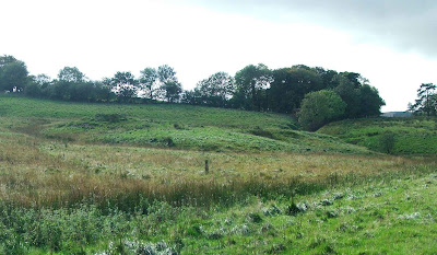
This stone circle was visited in June 2008, along with many towers and castles in the area. If you're not aware that this circle here, it is all too easy to pass on by, as it is hidden away in a field off the main road, and although it's the largest stone circle in Scotland, and the fifth largest in the UK, it is fairly indistinguishable from the landscape in which it can be found.


The above photo gives some indication of how flat the area is, and how the fallen stones blend into their surroundings.
The circle lays some two miles to the North of Dumfries, and about a quarter of a mile South of the small village of Holywood. There is room to park at the side of the B729 (about half a mile off the A6 to Thornhill)

There are eleven stones remaining out of a possible original nineteen, with all but five of the stones now fallen. Of these five standing stones, the tallest is around 1.9metres tall, with the largest measuring around 3.5 by 2.5 metres. The diameter of the circle stands at around 88 metres.

It is estimated that the circle dates from around 2000BC and is one of many prehistoric earthwork features in the area.

Only four of the stones are of local origin, with the rest from quarries some miles away. The circle used to be split in half by a field boundary, but this was removed in the 1880's completing the circle again, and allowing full access.

Although there is no public right of way through the field in which the circle sits, it appears that the land owner, fearful perhaps that his walls would be damaged, has kindly built a stile over the wall.

Some of the stones have marks on that bear a passing resemblance to 'cup and stone' marks....early stone decoration. Most documentation on this site however, advises that these marks are probably the result of weather erosion.

This site is definitely worth a visit, although lower your expectations so that you won't be disappointed.

Sunday, October 19, 2008

Cappelside Hall, Autumn 2008 visit

Cappelside Hall
Nr Beetham
Cumbria

The remains of Cappelside Hall, as mentioned in the original post some time ago, are hidden, off the beaten track, and otherwise not accessible. The remains can be found at the foot of a hill in a field, sandwiched between Paradise Lane and Pool Darkin Lane, just off the A6 near Beetham Garden Centre. There isn't parking readily available nearby, so a walk is required.

Once over the brow of the hill, and heading South East across the field, the remains can be seen at the foot of the hill before you. Basically, you're looking at the remains of the South end of a hall house, constructed some time during the 1400's, possibly on the site of an earlier building. The Hall and its tower would have stood around 11 and a half metres by 7 and a half metres, with walls somewhere around a metre and a half thick.

View of the garderobe in the South Western face of the pele tower's single surviving wall.

View of the South Eastern wall of the pele tower.

View from the West, showing the Southern surviving wall.

The garderobe entrance can be seen at the top right of the photo. At this part of the wall, the stone plinth upon which the tower was built can be seen in the grass.

Map of the layout of Cappelside Hall, based on Curwen's work. Some of the layout is probably pure conjecture on the part of Curwen, but there are earthworks all over the site, suggesting buried walls and features.

A shot of the only upstanding remains of the pele tower from the West looking down Cappelside Hill towards the direction of the Garden Centre. It's interesting to note, that the remains do not appear on the map...strange that such an important manorial site does not get a mention!!?! However...if you look carefully at the map, just above the A in Cappelside Hill...there is a curious [ shape....perhaps indicating the edges of the building!

There are feint earthwork remains to the North West of the standing remains, representing a kitchen block, and a larger hall block....all now long gone. These two areas were dismantled in 1687, when the property passed by marriage to the Cliffords. The tower was converted to use as a barn at this time.

Parts of the surviving walls stand to around 12 feet at their tallest, whilst the rest are either ground level or just above. A fence that runs to the East of the remains seems to be mounted on what looks like an old wall boundry, long since dismantled. I wonder if this is a boundary that would have been in existence when the hall was being used. As well as this, there are mounds of masonry against the walls to the north of the remains, possibly parts of the original buildings.

This visit to the remains was much better, yielding a better set of photographs.

Sunday, October 12, 2008

Sedbergh Castle Haugh, Autumn 2008 visit

Castle Haugh\Castle Haugh Tower
Sedbergh
Cumbria

Another site re-visited recently, was the motte and bailey castle at Sedbergh. A small, very well preserved and defined fortification with a complete motte and bailey, this earthwork is a pleasure to visit.

Although the trees are still in leaf, it's easy enough to make out the various parts of this fortification. The bailey, a raised earthen platform some 8 metres above the surrounding fields, is just visible behind the trees in the photo above.

The motte is superbly preserved. It still stands to around 30 feet high, and is very steep sided and difficult to climb.

To the East side of the motte, a more recent field wall is built on top of the bank on the outside of the ditch. It only serves to accentuate the steepness of the sides of the ditch, especially here.

The motte is surrounded by a ditch on all sides, except on its South side, where there is a natural scarp dropping away to the fields some way below. The ditch surrounding the motte is about 10 to 15 feet wide, and around 6 to 8 feet deep.

The section of ditch between the motte and the bailey is somewhat deeper, and the sides are much steeper.

The footings of the observation post mounted on the bailey are still visible.

The bailey is basically a huge raised platform, measuring around 40 feet by 80 feet, and is triangular in shape.The castle is easily accessible via a well marked footpath from the middle of the village. It's fairly easy walking, although not suitable for prams and wheelchairs.

Greenholme Motte and Bailey, Tebay

Greenholme Motte and Bailey
Tebay
Cumbria

There is some doubt about this site being a motte and bailey castle....even an unfinished motte and bailey castle, as some sources suggest. Local documents tell of two castles built in the Tebay area, to stop marauding Scots from passing through the area and onto Lonsdale and Kentdale further South. Castle Howe near junction 38 of the M6 motorway is undoubtedly an early medieval motte and bailey castle....the remains of the motte, ditches, banks and an extensive bailey area are all clear evidence of this.

Walking into the field behind the farm, it took a while before I could even make out this earthwork feature. The old course of Birk Beck can clearly be seen in the field, some 50 yards or so the South of the current water course. The remains of the fortification, if that is what they are, would therefore have been about 20 yards or so from the waters edge, much the same as Castle Howe's situation. The motte, or enclosure, has an internal area of some 23 metres by 9 metres, and rises no more than four feet or so above the surrounding area.

There are clear ditches to all sides of these remains, fed by a beck that runs from the top of the field above it. They were clearly water filled on the day I visited, and the ground around this feature was water logged and boggy.

The photo above, shows the feature in the field to the South of Birk Beck. I wouldn't say that this would have been an ideal place to locate a fortification, as the area to the south is higher, as is the area to the West, making this a somewhat vulnerable site. If this is in any way connected with the motte and bailey closer to Tebay, it may have just been a watch post, possibly to warn of any Scottish incursions.

Click on the images for full screen views.

Arnside Tower....2008 Autumn visit

Arnside Tower
Arnside
Cumbria

I've been back to Arnside Tower near Arnside and Silverdale....probably one of the grandest towers in the South Lakes area. This time, with better weather, the photos are a bit better than those previously posted here.

Built sometime in the later part of the 14th century, the tower is almost unique in Cumbria in that it was a free -standing tower with no attendant buildings around it. Severely damaged by fire accidentally in 1602, repaired and occupied for a time after this, the tower was eventually stripped of its roof timbers and other building materials in the 1680's.

Whilst entry to the remains are forbidden, the structure appears in the Heritage At Risk, North West report of 2008 stating that it is in need of consolidation work, it is easy to see the interior without placing yourself at risk, as the whole of the South West wall has collapsed, exposing the interior. From this vantage point, the interior walls can be viewed, with the remains of some of the walkways, built within the thickness of the walls, and parts of staircases can still be seen.

It's obvious when you're this close to the ruins, that there is much work to be done to secure the mere survival of this building, with many lintels showing the strains of carrying stone work above them.

Some windows and doors have even been robbed of their lintels, further straining the fabric of the building. The spiral staircase, hidden in the thickness of the North East wall, connected all floors, and can still partially be seen, even though the cross wall has totally collapsed.

This portion of the cross wall probably survived the storm of 1884 which finally brought the main part of it down, as it's the thickest part of the structure. The oven in the North Western projection of the tower is also fairly intact. Part of the arch over the oven entrance is missing, but the vaulted roof of the interior is still intact.

The photo below, shows the interior of the oven. The vaulted nature of the ceiling can just be seen.

Portions of the now collapsed South Western wall lay in a heap both within the confines of the tower, and outside.

There is fallen masonry everywhere, and it looks likely that there is a good four or five feet at least, of roof and wall rubble within the tower itself, and spilling out around the walls.

Portions of the upper parts of the tower still retain their corbels, obviously indicating that some additional height would have existed in the tower's heyday.

These days the tower is a mere curiosity, holding a magnificent place in the foot of the valley between Arnside Knott and Elmslack.